Summary
The CP_ANNOTPOINTS command in CADPower enables users to annotate points in a drawing with meaningful text labels based on their layer names. This tool is especially useful for surveying, mapping, and other applications where raw data points need to be organized and annotated with descriptive information.
CADPower -> Annotation Tools -> Annotation Tools -> Annotate points, based on layer names

Key features include:
- Layer-Based Annotation:
- Annotate points according to their respective layers using a lookup table for mapping annotation parameters.
- Custom Annotation Settings:
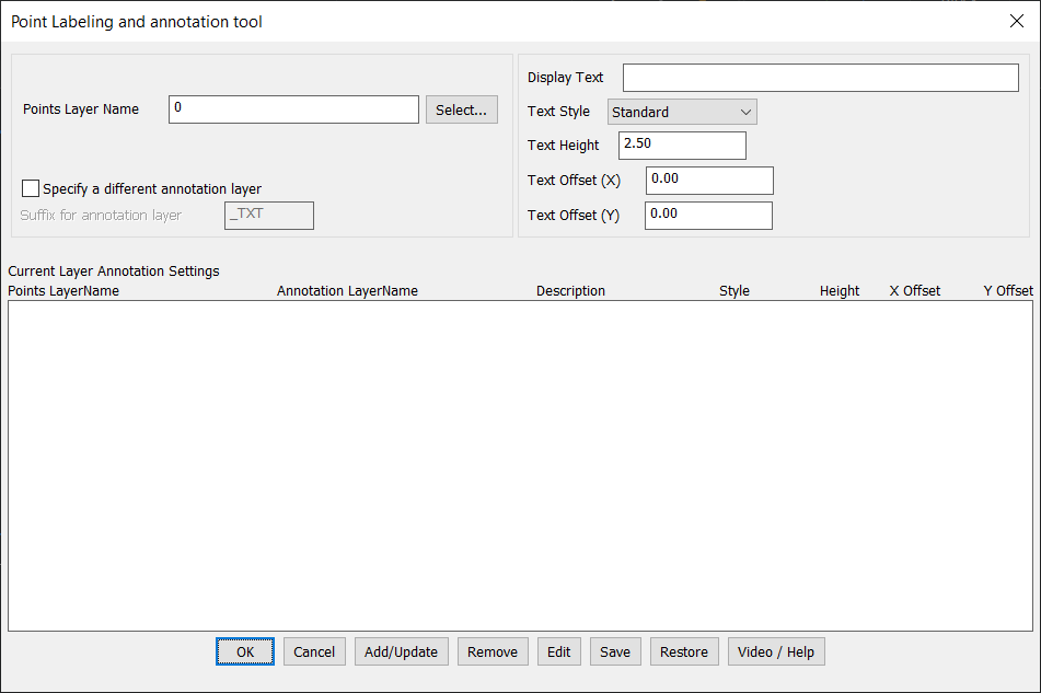
- Display Text: Define the label text to appear for each layer.
- Text Style: Choose from available text styles to match project standards.
- Text Height: Specify the height of the annotation text for clarity and consistency.
- Text Offsets (X, Y): Adjust horizontal and vertical placement offsets to ensure proper alignment with the points.
- Flexible Layer Management:
- Specify a separate annotation layer for better organization.
- Automatically append a suffix (e.g., “_TXT”) to create a dedicated annotation layer for each points layer.
- Save and Restore Annotation Parameters:
- Save layer-based annotation settings to an ASCII file for reuse across projects.
- Restore saved settings to quickly reapply consistent annotations in similar drawings.
- Interactive Interface:
- Add or update annotation settings for individual layers directly within the interface.
- Easily remove or edit existing settings as needed.
- Batch Annotation:
- Annotate a large set of points placed across multiple layers in one operation, streamlining workflows for large datasets.
- Applications:
- Ideal for surveying projects where points are organized by feature-specific layers (e.g., boundary points, control points, elevation points).
- Useful in mapping and civil engineering tasks to provide descriptive annotations for raw point data.
- Integrated Help and Support:
- Access video tutorials and detailed help documentation directly from the command dialog.
Use Case:
The CP_ANNOTPOINTS command is an indispensable tool for professionals in surveying, GIS, and civil engineering. It ensures efficient and accurate point annotation, enabling clear communication of point data across projects.