


Data Cleanup & Optimization
All data cleanup and optimization techniques found in AutoCAD Map like polyline vertex weeding, densification, fixing of overshoots and under-hangs, intersection cleanup based on snapping etc. are handled by Geo Tools in an efficient manner.
![]()
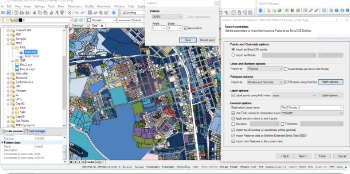
Topology Building
Building meaningful data from disconnected ones is always one of the goals of GIS. GeoTools has tools to build closed polygons from disconnected but touching edges, create area annotations, attached database and export to Excel.
![]()
Geographic Coordinates conversion
Geo Tools offers complete coordinate conversion from UTM, Transverse Mercator, Albers and Lambert systems to Lat-Long and vice-versa, complete with datum shift handling etc.
![]()
Google Earth Interaction (Export/Import)
Geo Tools offers complete integration with Google Earth and allows KML/KMZ data import and export of vector data. All this is functionality that is found in Civil 3D software only. It is also possible to extract viewport image from Google Earth and bring it into CAD with geo-referencing.
Surveying & Terrain modeling
For surveying professionals and terrain designers, Geo Tools offers easy ability to create cross-sectional profiles, longitudinal sections, volume calculations, TIM grid creation, drawing of graded lines, traverse adjustments and so on.
![]()
Mining & Geology
Geo Tools also has a small section called Geological and Mining which is under development and in its initial design phases.
![]()
Planning & Visualization Tools
Geo Tools intends to add a set of planning and visualization tools for city and neighborhood planning, zoning analysis, flight path and buffer zone modeling and so on.
- All Posts
- blog-post