Summary
des
GeoTool -> Polyline Tools -> Process -> Polyline ‘Insert Vertex’ Tool
APolyline ‘Insert Vertex’ Tool: GT_POLYINSVX – GeoTools Command
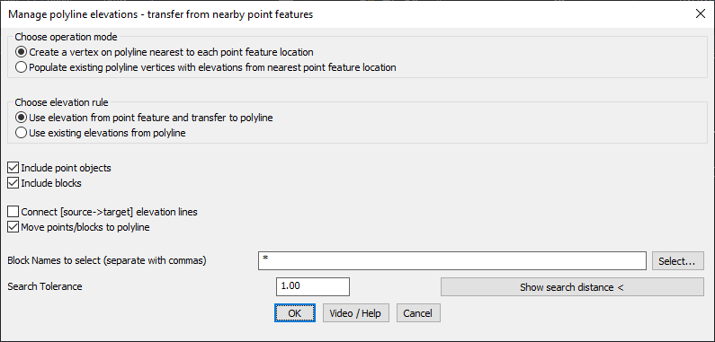
Key Features Include:
- Flexible Vertex Insertion:
- Create new vertices in a 3D polyline at locations nearest to selected point features.
- Populate existing polyline vertices with elevations from the nearest point feature.
- Customizable Elevation Rules:
- Transfer elevation from point features directly to the polyline.
- Use existing elevations within the polyline for interpolation.
- Advanced Filtering Options:
- Include point objects and/or blocks in the elevation assignment.
- Define specific block names for processing instead of selecting all.
- Enhanced Verification & Design Control:
- Connect [source → target] elevation lines for validation and design visualization.
- Move points/blocks to polyline after elevation transfer.
- Precision Control with Search Tolerance:
- Define a search distance to ensure points/blocks within this range are considered for processing.
Benefits:
This tool is essential for professionals working on surveying, terrain modeling, and civil engineering designs, ensuring accurate and seamless elevation assignments to polylines.