Summary
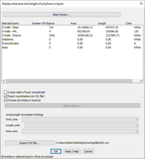
The GT_LAYERAREA command in GeoTools calculates and displays the total summed area and length of all polylines within selected layers, providing essential spatial data analysis in BricsCAD, AutoCAD, ZWCAD and ARES Commander.
GeoTool -> Polyline Tools -> Inquiry/Statistics -> Compute summed polyline areas from selected layers
Key Features Include:
- Layer-Based Area & Length Calculation – Computes the total area and length of polylines within user-specified layers.
- Layer Selection Flexibility:
- Click “Select Layers” to choose the layers to process.
- Displays a real-time summary of Number of Objects, Area, Length, and Color for each layer.
- Export & Reporting Options:
- Generate a Table – Create a tabular representation of layer areas and lengths for reference.
- Export Data to CSV – Save the computed values as a CSV file for further analysis in external applications.
- Batch Processing:
- Choose to process all entities in selected layers for a comprehensive area-length computation.
- Customizable Annotation Settings:
- Define DWG units, Length units, and Area units to match project requirements.
Benefits:
This tool is highly useful for architects, urban planners, GIS professionals, and civil engineers who need accurate area and length calculations for efficient project planning and documentation.