Summary
The GT_POINTWEED command in GeoTools is designed to remove redundant points or blocks that are positioned too close to each other, based on a user-defined distance threshold in BricsCAD, AutoCAD, ZWCAD and ARES Commander. This tool is particularly useful for data cleanup, GIS mapping, and survey point reduction, ensuring a more streamlined and optimized point dataset.
GeoTool -> Drawing Cleanup Tools -> Drawing Cleanup Tools -> Weed points based on spacing
Key Features Include:
- Removes Points or Blocks Below a Defined Spacing:
- Deletes points or blocks that are closer than the specified weed distance.
- Helps in reducing clutter and retaining only necessary points.
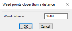
- User-Defined Weed Distance:
- Allows users to enter a custom distance value to determine the minimum spacing between points.
- Ensures that only significant points remain, improving clarity and usability of the drawing.
- Applies to Both Points & Blocks:
- Works with AutoCAD/BricsCAD POINT objects.
- Can also process blocks that represent points, making it useful for survey data, GIS layers, and terrain models.
- Considers Unit Precision:
- The precision for search distance is automatically set according to the current linear units precision in the drawing, ensuring accurate results.
Benefits:
This tool is essential for surveyors, CAD drafters, and GIS professionals, ensuring efficient point data management while maintaining the integrity of spatial information.