Summary
The GT_ANNOGRID command in GeoTools is used to generate a map grid with annotations for a given map sheet, making it an essential tool for cartography, GIS applications, and survey mapping in BricsCAD, AutoCAD, ZWCAD and ARES Commander.
GeoTool -> Geological/Mining Tools -> General -> Create Map Grid

Key Features Include:
- Customizable Grid Creation:
- Define the grid extents by selecting an existing sheet index block (created by GT_SHEETINS) or manually specifying the area.
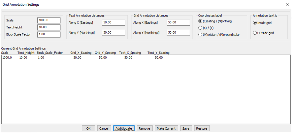
- Specify X/Y spacing for grid tick marks and grid annotation text.
- Flexible Annotation Options:
- Choose between inside grid or outside grid annotation placement.
- Customize coordinate labeling formats, including:
- Easting/Northing (E/N)
- X/Y Cartesian system
- Meridian/Perpendicular (M/P)
- Predefined and Customizable Blocks:
- Uses pre-defined blocks for grid tick marks and annotations (modifiable for custom styles).
- Editable block templates include:
- GRID_CROSS.dwg (grid tick marks)
- TICK_LEFT.dwg, TICK_RIGHT.dwg, TICK_TOP.dwg, TICK_BOTTOM.dwg (annotation blocks).
- Scalable Grid Management:
- Save and manage multiple annotation settings for different map scales.
- Settings can be stored and restored from ASCII INI files for future use.
- Set a preferred scale reference without affecting grid parameters.
Benefits:
This tool is ideal for surveyors, cartographers, and GIS professionals who need precise map grid annotation for mapping and documentation.
