Summary
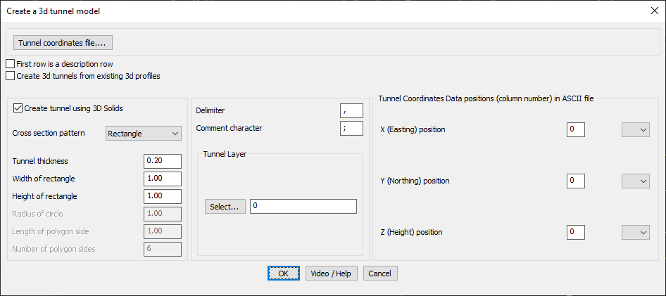
The GEOL_TUNNELMAKER command in GeoTools allows users to generate 3D tunnel models from coordinate data or existing 3D profiles, making it a vital tool for geotechnical, civil engineering, and mining applications in BricsCAD, AutoCAD, ZWCAD and ARES Commander.
GeoTool -> Geological/Mining Tools -> General -> Convert Civil 3D LandXML to CSV data
Key Features Include:
- Tunnel Creation Methods:
- Generate tunnels from coordinate files (ASCII format).
- Convert existing 3D profiles into tunnels for seamless integration with surveyed data.
- Cross-Section Design Options:
- Supports multiple cross-section patterns, including rectangles, circles, and polygons.
- Adjustable parameters such as:
- Tunnel thickness
- Width & height of rectangular sections
- Radius for circular sections
- Polygonal section properties (side length & number of sides)
- Tunnel Representation as 3D Solids:
- Creates tunnel geometry using 3D solids for accurate modeling.
- Assigns tunnels to a specified CAD layer for organized data management.
- ASCII File Data Import:
- Reads tunnel coordinate data from an ASCII file.
- Allows customization of delimiter (comma, semicolon, etc.) and comment characters.
- Define column positions for X (Easting), Y (Northing), and Z (Height) data.
benefits:
This tool is highly effective for tunnel alignment modeling, underground construction planning, and geological mapping, providing an automated workflow for 3D tunnel visualization and analysis.