Summary
The GEOL_BOREHOLELOGGER command in GeoTools allows users to import and visualize borehole data from ASCII files, making it an essential tool for geologists, mining engineers, and geotechnical professionals working in BricsCAD, AutoCAD, ZWCAD and ARES Commander.
GeoTool -> Geological/Mining Tools -> Bore-Hole -> Import bore-hole data
Import Bore-Hole Data: GEOL_BOREHOLELOGGER – GeoTools Command

Key Features Include:
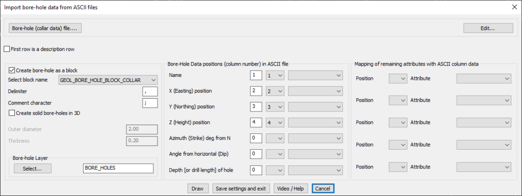
- Import Borehole Data from ASCII Files:
- Load borehole collar data from a structured ASCII file.
- Supports multiple column delimiters (e.g., comma, semicolon) for data parsing.
- Option to mark the first row as a description header for clarity.
- Borehole Representation in CAD:
- Create boreholes as blocks using predefined GEOL_BORE_HOLE_BLOCK_COLLAR symbols.
- Option to generate solid boreholes in 3D with adjustable outer diameter and thickness.
- Assign boreholes to a specific CAD layer (e.g., BORE_HOLES).
- Customizable Data Mapping:
- Assign column numbers for:
- Borehole Name
- X (Easting), Y (Northing), and Z (Height) positions
- Azimuth (Strike) and Dip (Angle from Horizontal)
- Depth (or drill length) of the borehole
- Assign column numbers for:
- Flexible Attribute Mapping:
- Map additional custom attributes from ASCII columns for advanced borehole analysis.
- Efficient Workflow Options:
- Draw boreholes in CAD immediately.
- Save settings and exit for future data imports.
Benefits:
This tool is essential for exploration geology, mineral resource estimation, and geotechnical site investigations, ensuring precise borehole placement and data management in CAD environments.
