Summary
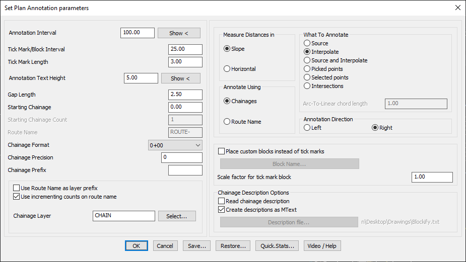
The GT_CHAINAGE command is used to annotate chainage distances along a traverse, which must be drawn as a 2D or 3D polyline. This tool enables precise labeling of chainages at defined intervals, vertices, or selected points along the route.
GeoTool -> Geological/Mining Tools -> General -> Annotate chainages along a route
Key Features Include:
- Annotation Options:
- Source: Annotates chainages at each vertex of the polyline.
- Interpolate: Annotates at a fixed regular distance along the polyline.
- Source & Interpolate: Combines both methods for greater flexibility.
- Picked Points: Manually select points for annotation (always uses slope measurements).
- Selected Points or Intersections: Annotates based on specific selections.
- Chainage Formatting & Route Naming:
- Users can choose to annotate using chainage values or route names.
- Supports multiple chainage formats (e.g., 0+00, 0+000, 0+0000).
- Customization Options:
- Adjust annotation interval, tick mark size, and gap length between text and tick marks.
- Option to use route name as a layer prefix for better layer organization.
- Option to use incrementing counts on route names.
- Choice of left or right alignment for annotation text.
- Block-Based Annotation:
- Allows placing custom blocks instead of tick marks for chainage labeling.
- Scale factor adjustment available for tick mark blocks.
- Chainage Description Import:
- Supports importing chainage descriptions from a comma-separated file (CSV/TXT).
- Useful for adding site-specific annotations such as intersections, landmarks, or elevation points.
- File Export & Configuration Management:
- Chainage data can be saved as CSV files for use in Excel or GIS applications.
- Command settings can be saved and restored for future use, improving workflow efficiency.
Benefits:
This tool is ideal for roadway alignment planning, surveying applications, and linear infrastructure projects, ensuring clear and precise annotation of distances along a designed route.