Summary
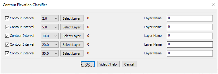
The GT_CONTCLASS command in GeoTools allows users to classify and organize contour lines by elevation interval, making it a powerful tool for terrain analysis, topographic mapping, and GIS-based contour management in BricsCAD, AutoCAD, ZWCAD and ARES Commander.
GeoTool -> Miscellaneous Tools -> Miscellaneous Tools -> Classify elevation contours
Key Features Include:
- Contour Interval Classification:
- Define up to five contour intervals (e.g., 2.0, 5.0, 10.0, 20.0, 50.0).
- Assign each interval to a specific layer for structured organization.
- Layer-Based Contour Management:
- Assign contours to custom layers for better visualization and filtering.
- Supports both Polyline objects and LDDT contour objects.
- Applications in Terrain Analysis:
- Classify contours to highlight elevation bands for improved readability.
- Create filtered contour maps showing only specific elevation ranges.
- Useful for hydrology, civil engineering, and land development planning.
Benefits:
This tool enhances topographic visualization and GIS data structuring, ensuring efficient contour classification for further analysis and mapping.