Summary
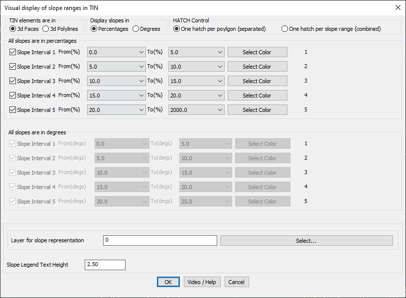
The GT_SLOPEDISPLAY command in GeoTools visually represents terrain slopes by color-coding TIN triangles (3D faces or 3D polylines) based on user-defined slope ranges. This tool is essential for topographic analysis, grading studies, and GIS applications in BricsCAD, AutoCAD, ZWCAD and ARES Commander.
GeoTool -> Geological/Mining Tools -> General -> Color-coded Slope Display (of TIN faces)
Color-Coded Slope Display (of TIN faces): GT_SLOPEDISPLAY – GeoTools Command
Key Features Include:
- Slope Classification & Color Coding:
- Define up to 5 slope ranges with custom start and end values.
- Assign distinct colors to each slope range for easy visualization.
- Flexible Slope Display Options:
- Choose to display slopes in percentages (%) or degrees (°).
- Supports TIN elements in both 3D Faces and 3D Polylines.
- Customizable Hatching & Visualization:
- Apply one hatch per polygon (individual faces) or one hatch per slope range (grouped).
- Use solid hatch fills or solid object fills for enhanced clarity.
- Export & Data Management:
- Export slope data to CSV format for further analysis.
- Supports slopes up to 2000% (87 degrees) for steep terrain mapping.
- Layer & Text Control:
- Assign a specific layer for slope representation.
- Adjust slope legend text height for better readability.
Benefits:
This tool is particularly useful for civil engineers, surveyors, and GIS professionals needing accurate and visually effective slope analysis for terrain modeling and site development.