Summary
The GT_LINPOLY command in GeoTools converts arced polylines into linear segmented polylines, ensuring compatibility with applications requiring straight-line segments in BricsCAD, AutoCAD, ZWCAD and ARES Commander.
GeoTool -> Polyline Tools -> Create/Edit -> Draw linear polylines from arced polylines
Key Features Include:
- Convert Arced Polylines to Linear Segments:
- Replaces curved polyline segments with a series of straight-line segments.
- Improves Compatibility:
- Essential for GIS, topographical mapping, and CAD applications that do not support arc-based polylines.
- Batch Processing Capabilities:
- Allows quick conversion of multiple polylines while maintaining geometric accuracy.
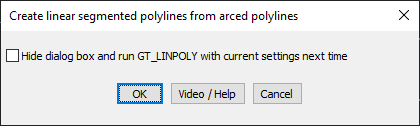
- Automatic Execution Mode:
- Option to hide the dialog box and run GT_LINPOLY with the previously used settings.
Benefits:
This tool is valuable for surveyors, engineers, and designers who need to work with simplified linear representations of complex curved polylines.