Summary
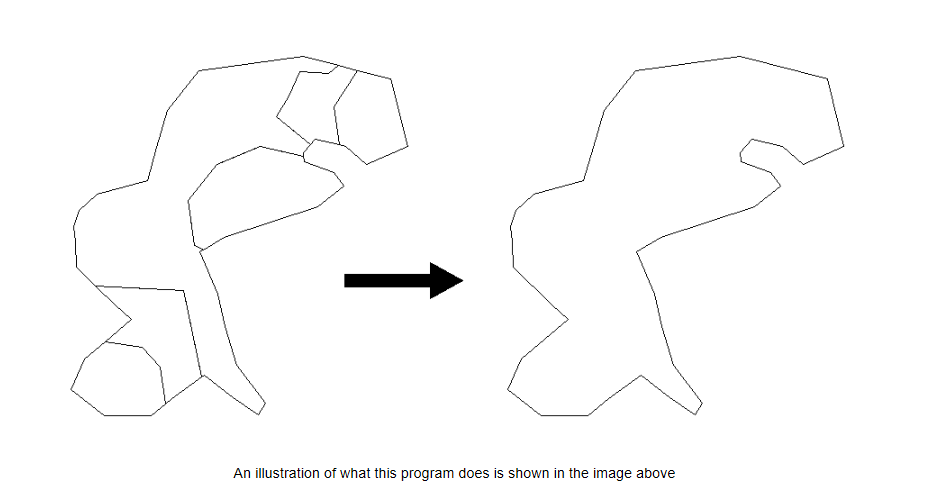
The GT_MERGEPOLY command in GeoTools is designed to merge adjacent closed polylines with overlapping boundaries, creating a single external outline. This ensures efficient polygon management within BricsCAD, AutoCAD, ZWCAD and ARES Commander.
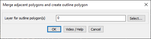
GeoTool -> Polyline Tools -> Process -> Merge adjacent closed polylines
Key Features Include:
- Automatic Merging of Adjacent Polylines – Identifies and combines overlapping closed polylines into a single outline polygon.
- Retains the Outer Boundary – Ensures that only the outer-most external boundary is preserved while eliminating internal divisions.
- Custom Layer Selection – Define the target layer for the resulting outline polygon.
- Ideal for GIS and Mapping Applications – Particularly useful for land parcel management, zoning maps, and topology processing where adjacent areas need to be consolidated.
- Boundary Overlap Requirement – Polygons must share common overlapping segments for successful merging; non-overlapping polygons remain unaffected.
Benefits:
This tool is essential for GIS professionals, urban planners, and cartographers, ensuring clean and efficient polygon topology in CAD environments.