Summary
The GT_MULTEXPORT command in GeoTools enables users to export multiple DWG files into various formats, ensuring compatibility and flexibility in BricsCAD, AutoCAD, ZWCAD and ARES Commander.
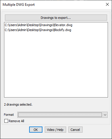
GeoTool -> Export Tools -> Export Tools -> Multiple drawing export in various formats
Key Features Include:
- Batch Export of Multiple DWG Files:
- Allows users to select multiple drawings and export them in one go.
- Supported Export Formats:
- 3D Studio (3DS) – 3D modeling exchange format.
- Metafile (WMF) – Windows Metafile for vector graphics.
- ACIS (SAT) – Solid modeling format for interoperability.
- Bitmap (BMP) – Raster image format.
- Lithography (STL) – Used for 3D printing and rapid prototyping.
- Encapsulated PostScript (EPS) – Graphics exchange format for publishing.
- 3D DWF / DWFx – Compressed CAD format for design sharing.
- DGN (V7/V8) – Format used in MicroStation and other BIM applications.
- Remove or Modify Drawings from Selection:
- Users can remove selected drawings before exporting.
- Format Selection:
- Choose the required export format from a dropdown menu.
Benefits:
This tool is essential for architects, engineers, and CAD professionals who need to convert and share drawings across different software platforms and workflows.