Summary
The GT_BRGROUND command in GeoTools is designed to round off bearing values to a specified precision, ensuring consistent and precise angular measurements in BricsCAD, AutoCAD, ZWCAD and ARES Commander
GeoTool -> Geological/Mining Tools -> General -> Round off bearings
Key Features Include:
- Bearing Format Compatibility:
- Supports various common bearing representations, such as:
- Degrees, minutes, and seconds (DMS) (e.g., 149° 49′ 32″)
- Decimal degrees (e.g., 50-23-24)
- Directional bearings (e.g., N 149° 41′ 27″ E)
- Survey-style notations (e.g., S 85d27′ E)
- Supports various common bearing representations, such as:
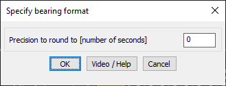
- Precision Control:
- Rounds off only the seconds part of the bearing.
- Users can define the precision in seconds for rounding (e.g., rounding to the nearest 5, 10, or 15 seconds).
- Ensures Standardized Bearings:
- Eliminates minor discrepancies in survey and mapping data.
- Improves readability and consistency for engineering and cadastral applications.
Benefits:
This tool is highly beneficial for surveyors, GIS professionals, and civil engineers who require accurate bearing representation and rounding in their CAD drawings.