-
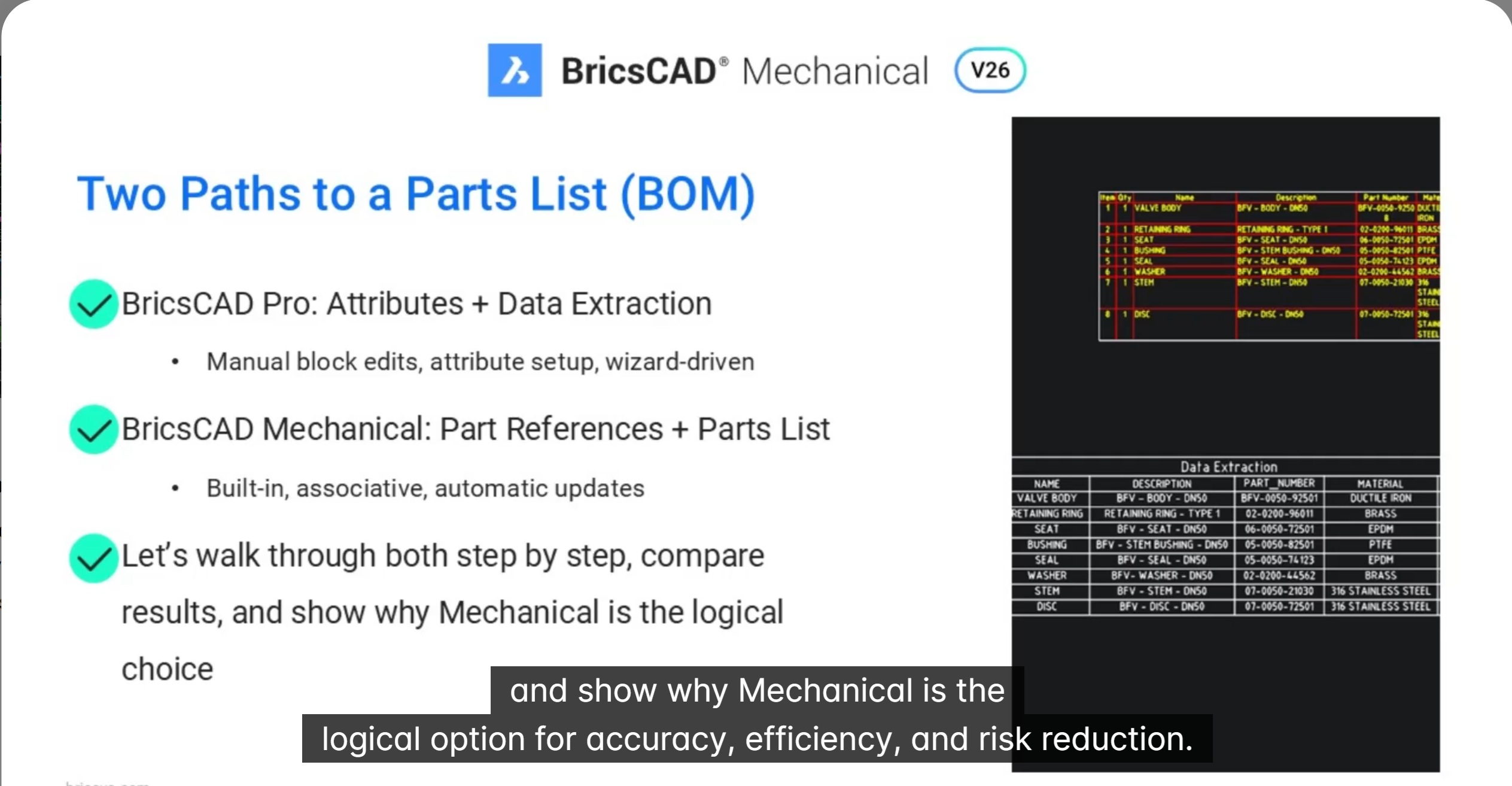
Parts List in BricsCAD Mechanical vs data extraction in BricsCAD Pro
In this blog we will see how associative part Lists in BricsCAD Mechanical outperform BricsCAD Pro’s data extraction in speed and accuracy. Creating accurate parts lists is critical for manufacturing workflows—but the way you build them can dramatically impact speed, accuracy,… Read More
-
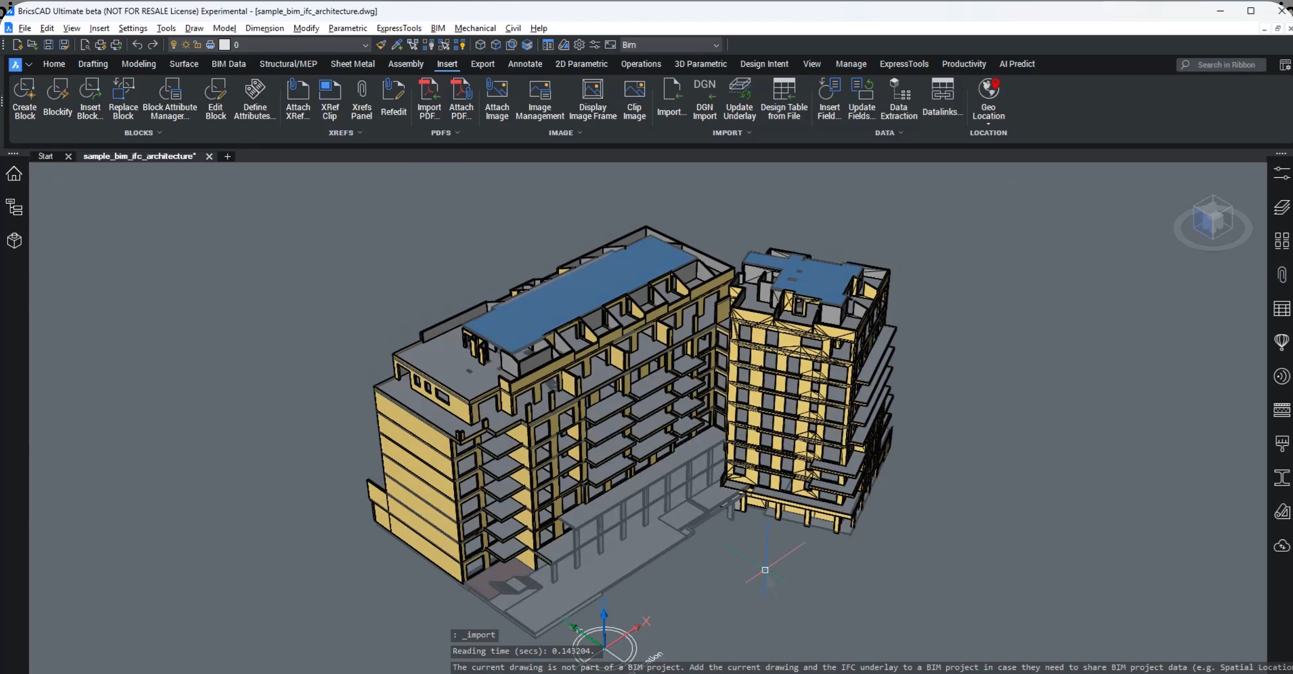
New data coordination in BricsCAD with IFC imports as XRefs
In this blog, we will learn about new data coordination in BricsCAD with IFC imports as XRefs. Open data is only valuable when it is usable, trustworthy, and easy to coordinate. In this breakout session, BricsCAD introduces a major improvement… Read More
-

Create Labels for GIS data
In this blog we will talk about how to create labels for GIS data in BricsCAD V26. This is part of the sprint where we discover new features in BricsCAD Pro Civil which are shaping up quickly as a Civil3D… Read More
-
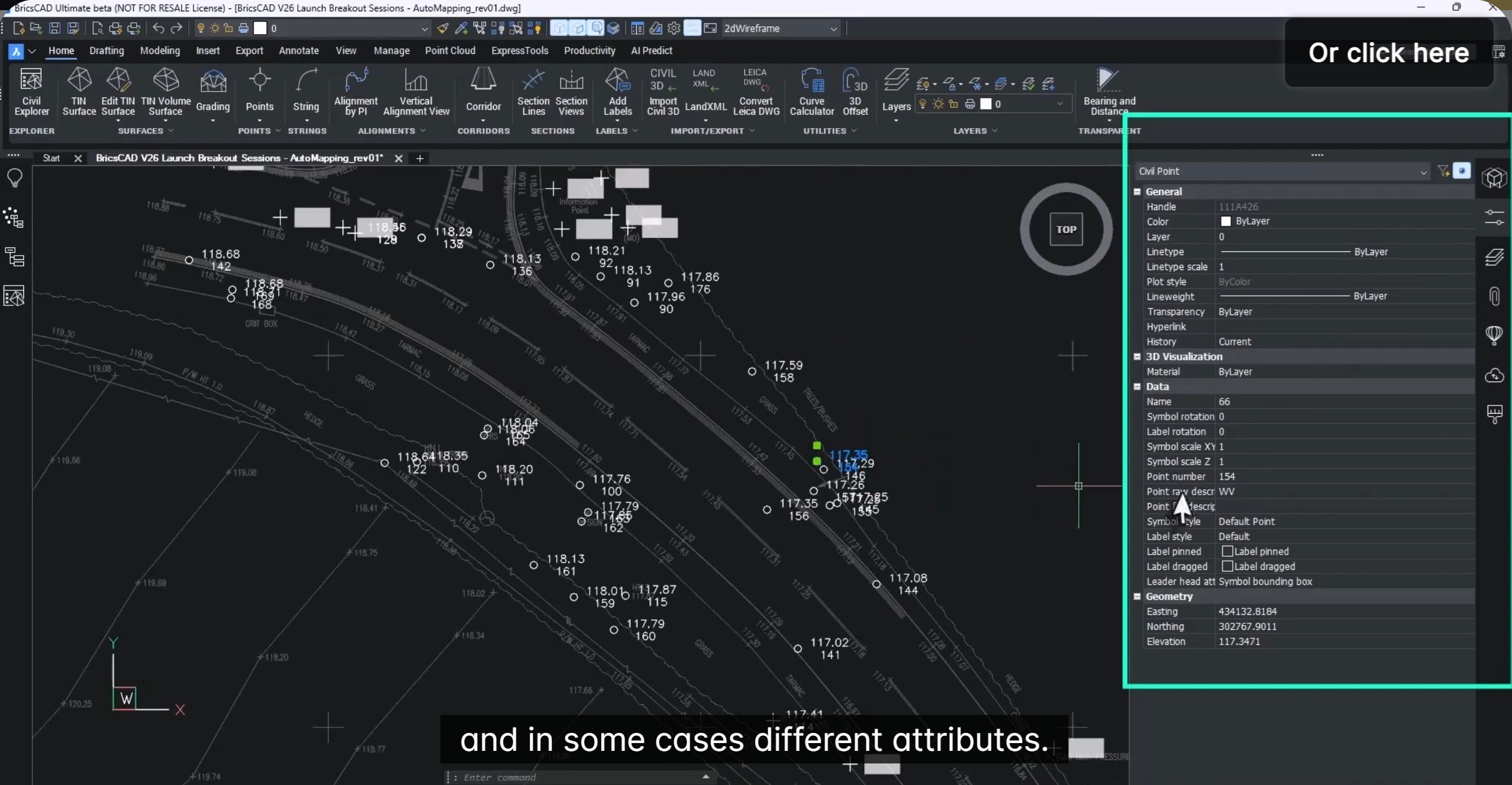
Set up Auto Mapping to manage Civil Points
In this blog, we will see how to set up Auto mapping to manage civil points. Managing large volumes of survey point data doesn’t have to be slow, repetitive, or error-prone. With BricsCAD V26, Bricsys introduces Automapping—a powerful enhancement to… Read More
-
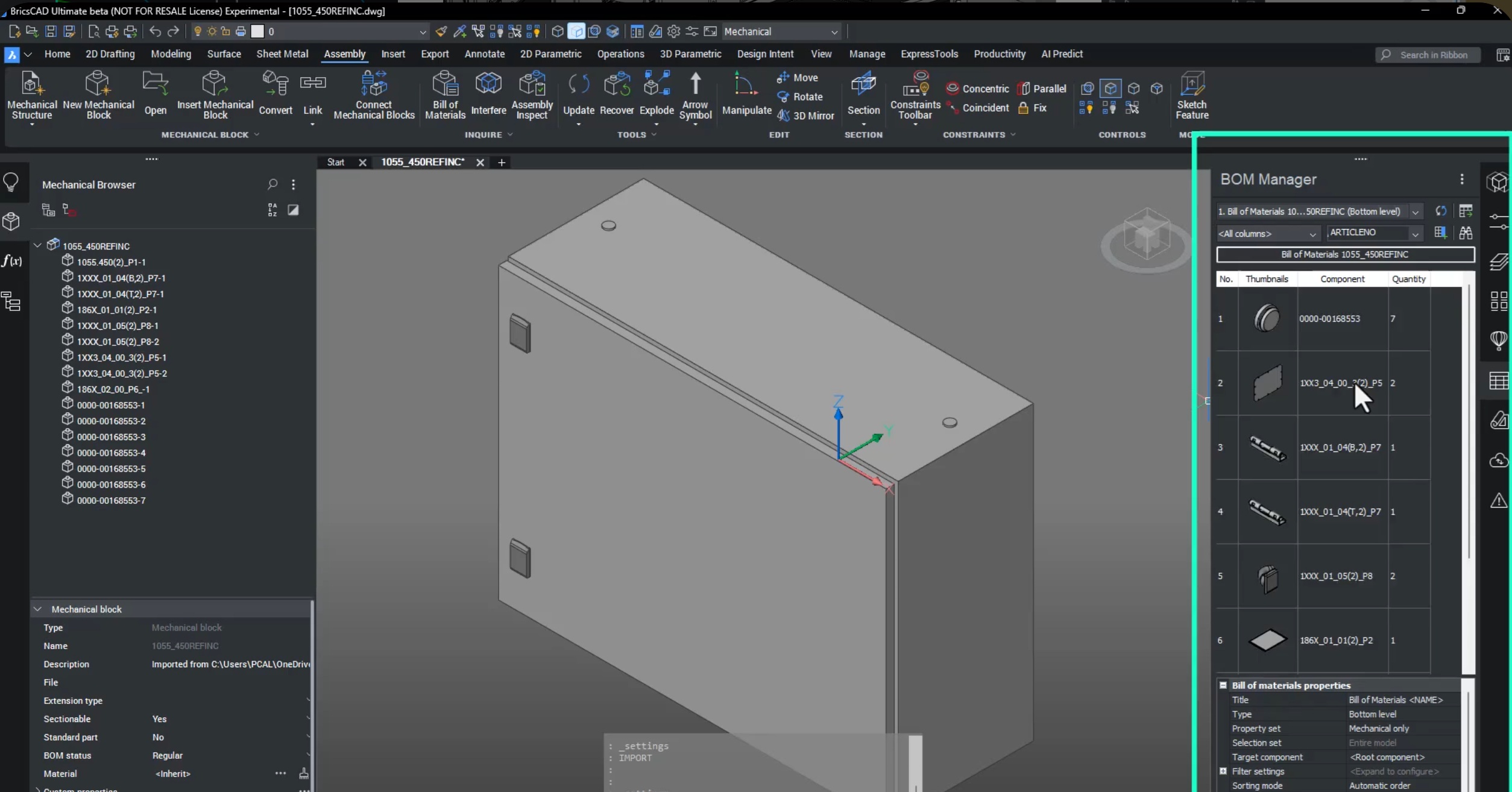
Seamless multi-CAD assembly modeling, part design and documentation
Seamless Assembly, Part Creation & Documentation with BricsCAD Mechanical V26. Modern manufacturing is no longer single-CAD. Parts come from suppliers, OEMs, and design partners using SOLIDWORKS, STEP, Inventor, and more — and yet everything must come together into one manufacturable… Read More

The Designsense Blogs
CAD Customization and application development services for:
Location:
- India |
- Andhra Pradesh |
- Arunachal Pradesh |
- Assam |
- Bihar |
- Chhattisgarh |
- Goa |
- Gujarat |
- Haryana |
- Himachal Pradesh |
- Jharkhand |
- Karnataka |
- Kerala |
- Madhya Pradesh |
- Maharashtra |
- Manipur |
- Meghalaya |
- Mizoram |
- Nagaland |
- Odisha |
- Punjab |
- Rajasthan |
- Sikkim |
- Tamil Nadu |
- Telangana |
- Tripura |
- Uttar Pradesh |
- Uttarakhand |
- West Bengal |
- Chandigarh |
- Jammu and Kashmir |
- Puducherry |
- Ahmedabad |
- Bengaluru |
- Bhopal |
- Chennai |
- Delhi |
- Dharwad |
- Hyderabad |
- Indore |
- Lucknow |
- Mumbai |
- Nagpur |
- Patna |
- Pune |
- Ranchi |
- Hubli |
- Hisar |
- Belgaum |
- Noida |
- Satara |
- Nashik |
- Aurangabad |
- Thoothukudi |
- Coimbatore |
- Surat |
- Gurgaon |
- Gurugram |
- Secunderabad |
- Visakhapatnam