Create buffers around existing geometries in AutoCAD
![]()
Among the spatial analysis tools included in ‘Spatial Manager’, the Buffer function allows you to generate Buffered polygons around point, linear (lines, polylines, etc.) or polygonal (boundaries) objects.
Buffers have multiple applications to analyze objects and their relationship with their own or other objects’ environment.

As you can review in the videos, through this example we will build a table including the data of the Hydrants that are close to the Roads of a municipality
First, we import the Hydrants (which are in a KMZ file from Google Earth) and the Roads (which are in a Shapefile) into a map of the city.
Note the ability of the application (CAD versions) to import at once all the data sources recognized within a folder or schema of a User Data Source, carrying out also the necessary coordinate transformations for each of these sources
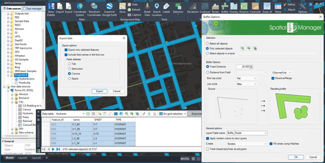
Then, using the Buffer function, we generate Buffers around the vial axes. Although the distance defined to generate the Buffer for each element can be variable taken from the data of a table, in this example we define a fixed distance of 25 feet from the axis.
In the videos you can also review other options of interest in the Buffer function that are applied in this example.
Finally, we make use of the Spatial Query selection function to select all the Hydrants that are “Within” the generated Buffer polygons, and, in the application Data Grid, we export the selected Hydrants data to a CSV file, which we can open and handled in MS Excel and many other applications
Learn More
Union of polygons with common data – Dissolve Polygons

It is often useful to create enveloping polygons from the union of other adjacent polygons that share some data in common
Show me how
Centroids and Polygons

It is very common that when handling polygonal spatial information (Parcels, Buildings, Zones, etc.), the polygon data is attached to its Centroid, a point element, usually inside the polygon, which concentrates its alphanumeric information.
