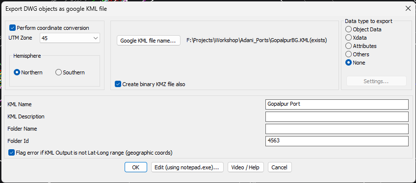
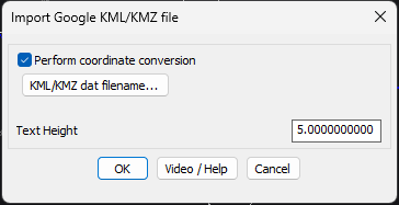
The GT_DWG2KML tool (above) and GT_KML2DWG tool (below) are available under Geographic Tools
GeoTools V 24.13 Export and Import KML with ease
GeoTools V 24.13 Export and Import KML with ease
GeoTools V 24.13 Export and Import KML with ease
A ground-breaking new tool in GeoTools V 24.13 (runs on BricsCAD V 24.2.03 and above)
In GeoTools V 24.13, we have added a new feature which users have been asking for along time. You can now export your UTM coordinates into KML format and open them in Google Earth.
On the return trip, you can bring in KML files from Google Earth and open them in their correct UTM coordinates in BricsCAD. This tool already existed earlier also, but you can now perform coordinate conversions (UTM to Lat-Long during DWG2KML, and Lat-Long to UTM during KML2DWG are supported).
Please be aware that we are using the underlying features of BricsCAD Civil to enable this coordinate conversion. So, you need to have BricsCAD V 24.2.03 Pro version or above to run this feature.
In lower versions of BricsCAD (or in AutoCAD, ZWCAD etc.), the tool runs just as a KML exporter and importer without doing any coordinate conversions. This is ok as long as you have your KML file already in your desired UTM coordinates or your DWG file in your desired Lat-Long coordinates.
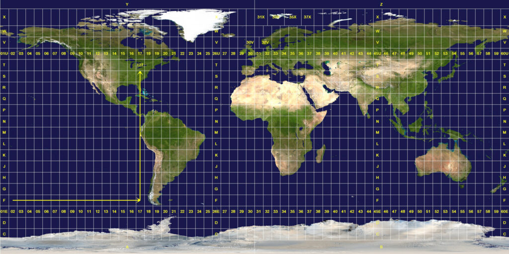
You will need to select your UTM zone correctly. By default, UTM Zone 43 (in India) is offered as the default. Please ensure you change to the correct UTM zone of your region before using the GT_DWG2KML tool. On the return journey, you don’t need to specify the UTM zone. It is determined automatically from the Lat-Long coordinates of the KML file.
Map showing the UTM zones of the world. Photo courtesy: Wikimedia Commons, the free media repository