-
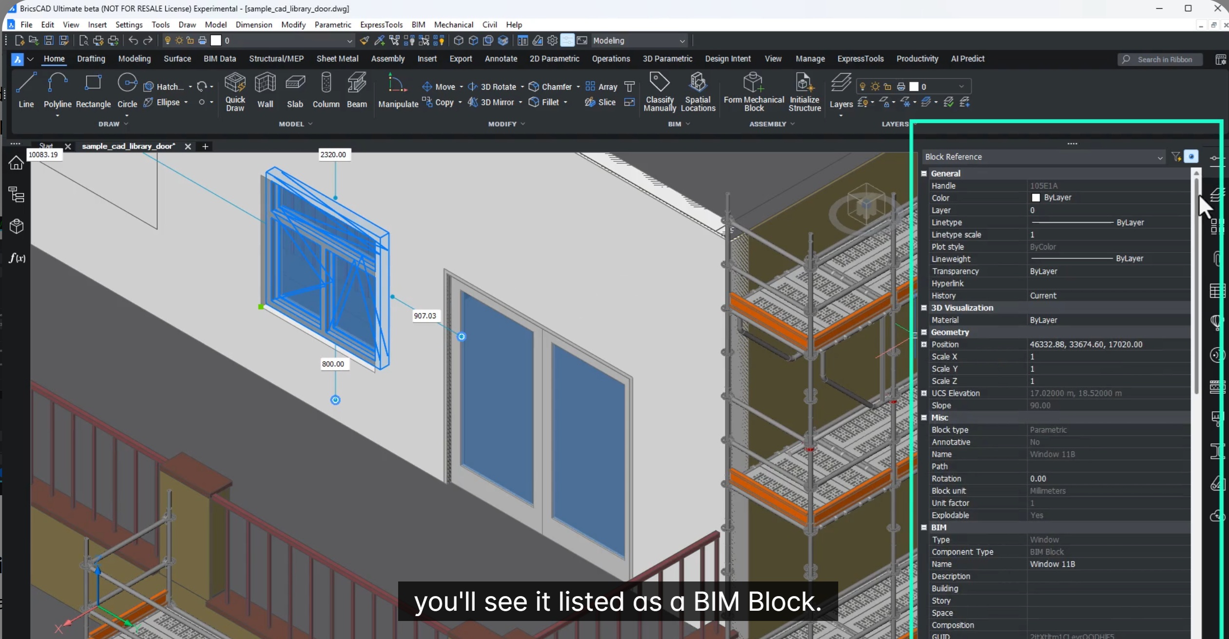
Build better content libraries with enhanced BIM Blocks
In this blog we will learn about how to build better content libraries with enhanced BIM blocks and also share better data and deliver faster. Introducing BIM Blocks & Mechanical Blocks in BricsCAD V26.1 In modern construction and manufacturing, the… Read More
-
GeoTools-CADPower V26.14 Update
In this blog, let’s talk about the GeoTools-CADPower V26.14 update. Since the release of the V26 version of GeoTools and CADPower in October 2025, we ave made several improvements and bug fixes. Today, we are pleased to announce to you,… Read More
-

Octave BricsCAD
Octave BricsCAD We are excited to share that Bricsys is entering a new chapter as we become part of Octave. If approved and completed, the spin-off will establish Octave as a standalone software company bringing together Hexagon’s Asset Lifecycle Intelligence… Read More
-
Generate Civil Points fast
In this blog, we will see how we can generate civil points fast in BricsCAD V26. Creating civil points is a critical step in every civil and surveying workflow. Yet, it is often one of the most time-consuming and error-prone… Read More
-
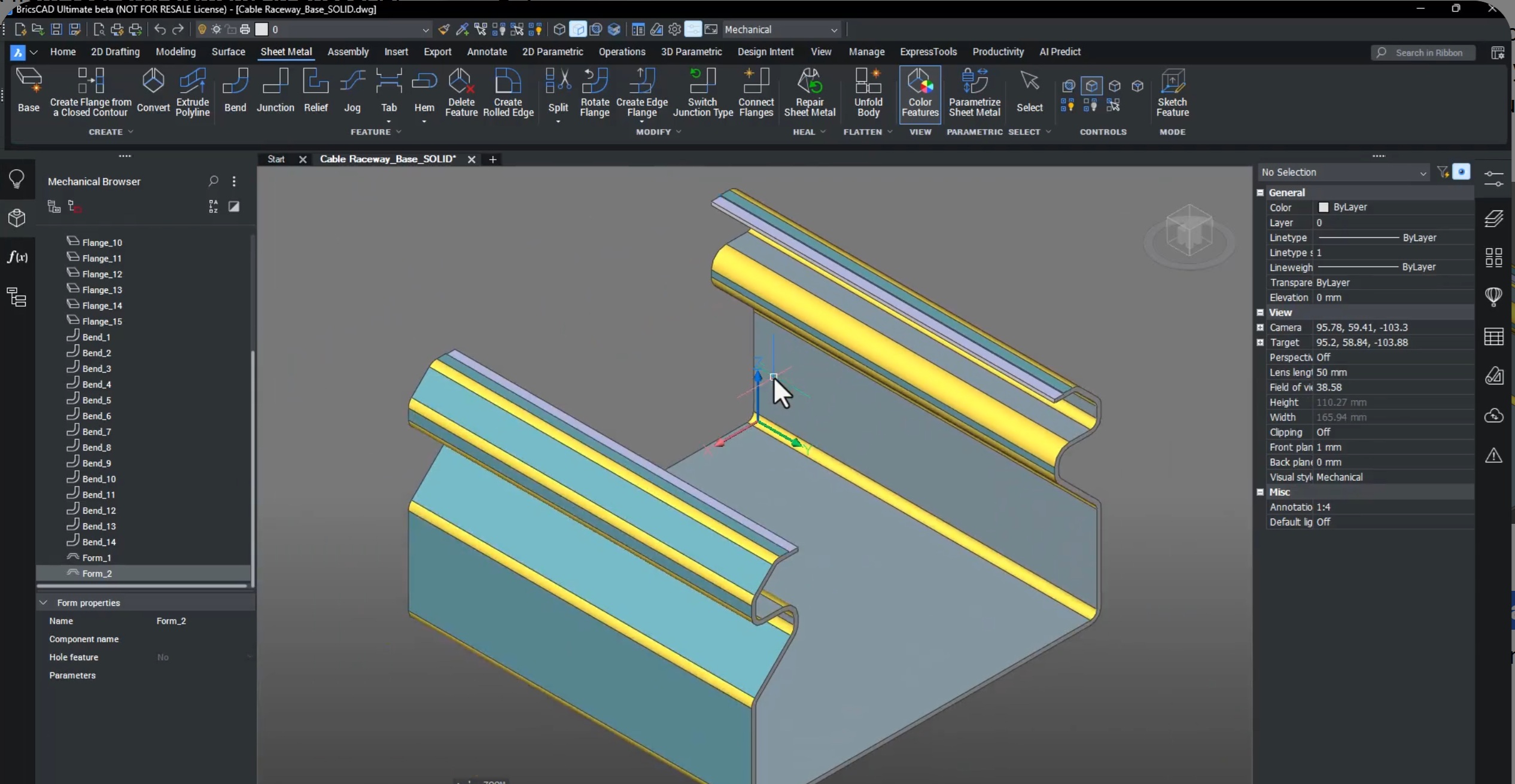
What’s new in BricsCAD Mechanical V26
In this blog, we will see what’s new in BricsCAD Mechanical V26. BricsCAD Mechanical V26 delivers a major productivity boost for mechanical engineers, fabricators, and sheet-metal designers. This release focuses on reducing clicks, improving accuracy, and accelerating everyday workflows across… Read More

The Designsense Blogs
CAD Customization and application development services for:
Location:
- India |
- Andhra Pradesh |
- Arunachal Pradesh |
- Assam |
- Bihar |
- Chhattisgarh |
- Goa |
- Gujarat |
- Haryana |
- Himachal Pradesh |
- Jharkhand |
- Karnataka |
- Kerala |
- Madhya Pradesh |
- Maharashtra |
- Manipur |
- Meghalaya |
- Mizoram |
- Nagaland |
- Odisha |
- Punjab |
- Rajasthan |
- Sikkim |
- Tamil Nadu |
- Telangana |
- Tripura |
- Uttar Pradesh |
- Uttarakhand |
- West Bengal |
- Chandigarh |
- Jammu and Kashmir |
- Puducherry |
- Ahmedabad |
- Bengaluru |
- Bhopal |
- Chennai |
- Delhi |
- Dharwad |
- Hyderabad |
- Indore |
- Lucknow |
- Mumbai |
- Nagpur |
- Patna |
- Pune |
- Ranchi |
- Hubli |
- Hisar |
- Belgaum |
- Noida |
- Satara |
- Nashik |
- Aurangabad |
- Thoothukudi |
- Coimbatore |
- Surat |
- Gurgaon |
- Gurugram |
- Secunderabad |
- Visakhapatnam