Under the Export section in both GeoTools and CADPower, you can find the CSV import/export tools. In this post, we discuss some of the lesser-know options and possibilities while using this tool.
One of the unique features of the CADPower (CP_IMPEX) and GeoTools (GT_IMPEX) commands is the ability to handle custom formats. We observed several CSV files, from complex irrigation, mining, roads and telecom survey data and found that most of them do not fit into the standard PENZD-type formats that most CAD survey processing software expect. Of course, you can use Excel and re-arrange the columns each time, but this is not what you would like to do when you have a 500-km project when every CSV file is in a certain custom format.
The IMPEX tool is built with this in mind. Inspired by the ability of Civil 3D to handle custom CSV formats, we set out to build a syntax that would help you process this data.
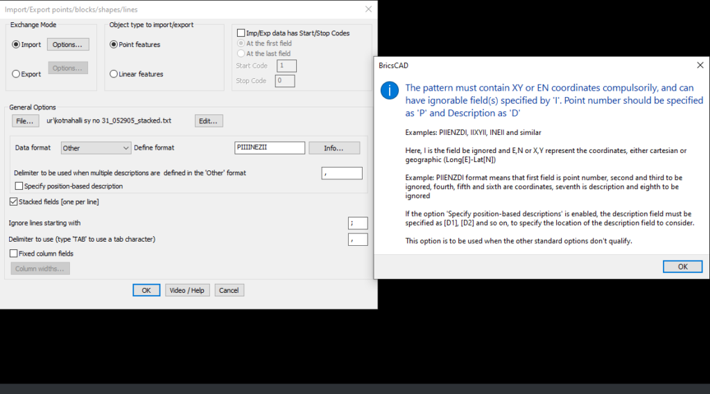
In the IMPEX tool, you need to specify “Other” as the format, and then ‘define’ your format using a simple syntactical formula.
The pattern must contain XY or EN coordinates compulsorily, and can have ignorable field(s) specified by ‘I’. Point number should be specified as ‘P’ and Description as ‘D’
Examples: PIIENZDI, IIXYII or INEII
Here, I is the field be ignored and E,N or X,Y represent the coordinates, either cartesian or geographic (Long[E]-Lat[N])
Example: PIIENZDI format means that first field is point number, second and third to be ignored, fourth, fifth and sixth are coordinates, seventh is description and eighth to be ignored
If the option ‘Specify position-based descriptions’ is enabled, the description field must be specified as [D1], [D2] and so on, to specify the location of the description field to consider.
This option is to be used when the other standard options don’t qualify
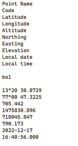
The custom format specification works for stacked coordinates also.